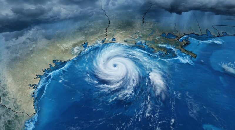
Tropical Storm Edouard Threatens Texas and Louisiana With Heavy Rain, Flooding and Storm Surge
Table of Contents
01 Event
Tropical Storm Edouard strengthened as it moved toward the Texas-Louisiana coast on September 1, 2026, bringing the threat of heavy rain, flash flooding, strong winds and coastal storm surge. The U.S. National Hurricane Center said the storm was strengthening before reaching the northwestern Gulf Coast, while officials in Texas identified flooding as the main danger.
At 10:00 a.m. CDT, the National Hurricane Center placed Edouard about 30 miles south of Cameron, Louisiana, and about 50 miles southeast of Port Arthur, Texas. Maximum sustained winds had increased to 50 mph, and the storm was moving northwest at 8 mph. Forecasters said additional strengthening was possible before landfall.
02 What Changed?
Edouard developed quickly from a tropical depression into a named tropical storm and became better organized as it approached land. Air Force Hurricane Hunters found strengthening winds, while radar showed a more organized inner core. The National Hurricane Center said continued intensification was expected before the storm reached the coast.
Warnings focused on water as much as wind. The National Hurricane Center forecast 3 to 6 inches of rain along the Texas coast through east-central Texas, with isolated totals of up to 9 inches. A storm surge of roughly 3 to 5 feet was possible near portions of the Texas-Louisiana border. Low-lying and urban locations faced the greatest flash-flood risk.
03 Why It Matters
Tropical systems do not need to become major hurricanes to create expensive or dangerous flooding. Heavy rain can overwhelm drainage systems, close roads, damage homes and interrupt transportation and power. Coastal surge adds another layer of risk because water can move inland before or during landfall even if the storm’s wind category remains relatively modest.
The event also illustrates why storm strength should not be judged only by the Saffir-Simpson hurricane category. That scale measures sustained wind speed, not rainfall totals or storm surge. A strengthening tropical storm can therefore produce serious impacts even without reaching hurricane status.
04 What It Means for You
For people in affected areas, the practical priority is official local guidance. Flooded roads are especially dangerous because water depth and road conditions are difficult to judge from a vehicle. Travelers should also expect the possibility of flight, road and service disruptions around Southeast Texas and southwestern Louisiana.
For consumers farther away, major Gulf Coast storms can sometimes affect logistics, insurance claims and energy infrastructure, although the actual economic effects depend on where the storm lands and what facilities are affected. It is too early to assign those consequences to Edouard without evidence.
Earnyx readers tracking weather-related disruption can compare this with our recent coverage of Metro Manila flooding after heavy Habagat rains, where the core lesson was similar: the headline weather system matters, but local flood exposure determines much of the real-world cost.
05 Numbers + Context
At the National Hurricane Center’s 10:00 a.m. CDT advisory, Edouard had maximum sustained winds of 50 mph and a minimum central pressure of 1000 millibars. It was moving northwest at 8 mph. Forecast rainfall was generally 3 to 6 inches, with isolated amounts up to 9 inches. A 3-to-5-foot storm surge was possible along part of the Texas-Louisiana coast.
Associated Press reporting said Texas officials were preparing for flooding and had crews clearing dry vegetation that could potentially ignite from lightning. The broader tropical picture was also active: Hurricane Lowell had formed in the Pacific southeast of Hawaii, while other systems were being monitored elsewhere. Those storms are separate systems and should not be treated as part of Edouard’s impacts.
06 Earnyx Takeaway
Edouard’s most important story is not whether it crosses the hurricane threshold before landfall. The immediate risk is the combination of strengthening winds, several inches of rain and coastal surge over populated and flood-prone areas. The numbers that matter most are rainfall, surge and the exact track—not simply the storm’s category.
Residents and travelers should rely on the National Hurricane Center, National Weather Service and local emergency officials for current conditions because tropical-storm forecasts can change quickly as a system approaches land.
Edouard was also a reminder that rapidly organizing Gulf systems can leave a relatively short preparation window. The National Hurricane Center’s morning advisories showed the storm strengthening from 40 mph to 50 mph as reconnaissance aircraft and radar observed better organization. That short-term change is why official advisories, not an earlier forecast snapshot, should guide decisions near landfall.
The storm also drew attention from the Gulf Coast energy sector before landfall. Reuters reported that Motiva Enterprises and Exxon Mobil were securing equipment and preparing their East Texas refineries for high winds and flooding. At the time of that reporting, the companies had not reduced production. Exxon said its Beaumont and Baytown refineries were operating normally and that its incident-command system had been activated.
Those facilities matter because the Port Arthur-Beaumont area contains some of the largest refining capacity in the United States. Reuters listed Motiva’s Port Arthur refinery at 656,400 barrels per day, Exxon’s Beaumont refinery at 612,000 barrels per day and Exxon’s Baytown refinery at 564,000 barrels per day. Valero’s 235,000-barrel-per-day Port Arthur refinery was also operating normally. Cheniere Energy and Freeport LNG were monitoring the storm without reporting production impacts at the time.
That is an important boundary for the economic story. Preparation at refineries and LNG facilities is evidence of exposure, not evidence of a supply disruption. Fuel-market effects should only be reported if facilities actually shut down, shipments are interrupted or prices move in response. Before landfall, the confirmed facts were precautionary measures and continued normal operations.
The same caution applies to travel and insurance impacts. A storm warning can trigger preparations and cancellations, but the final cost depends on the actual track, rainfall, surge and duration of disruption. Those effects should be measured after the event rather than assumed in advance.
Sources: U.S. National Hurricane Center, Tropical Storm Edouard Advisory No. 5, September 1, 2026; Associated Press, September 1, 2026; Reuters, August 31, 2026.